Many of those who support the sale of the 34 acres to BBL Construction for new development are impressed by the company’s donation of land to the Town of Clifton Park. However, Friends of Clifton Park Open Space has questioned the value and quality of this land donation. Now we wish to outline our concerns more specifically.
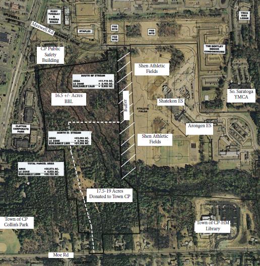
School Map of Donated Land
FACT—FRONTAGE: There is very limited frontage for two new roads necessary for any access to new development on the property:
The Shenendehowa School District has provided a map of the property which includes the donated land. One of the first details one notices is the very small frontage onto both Maxwell Road on the east and Moe Road on the west. For any development to take place, new roads must be constructed in and out of the property. This is a requirement for emergency vehicles as well as traffic flow.
At Maxwell Road, the Board has apparently also provided an Addendum which stipulates an easement onto school property to accommodate this need—something which will also require further negotiation with the town for additional access onto town property in order to accommodate any new road onto Maxwell Road. Even such an easement by the School for this necessary road would make a substantial cut into the buffer displayed on the school’s map. It would bring the new development and its traffic even closer to the Shatekon school property and force more land to be lost forever to this construction.
At Moe Road, the new road will run the length of the “donated” land to reach the new development on the east side of the 34 acres. It will cut the “donated” land in half making it both less desirable and less healthy. Not only will such a road make for a less desirable public park atmosphere, but it will also empty out directly across the street from the Shenendehowa Campus exit. One must consider the impact of trucks and traffic along these corridors, into the new donated parkland, with more cars, trucks, vans, tractor-trailers, etc., into traffic right across from the school campus.
FACT—SEQR (State Environmental Quality Review) has not been done on any of the land
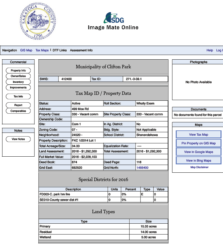
County Tax Map Land Description
Until a State Environmental Quality Review of the property is done, no one can know for sure the quality of the property within the parcel. However, Saratoga County Tax Records show that the property contains: 15.33 acres Primary land (buildable), 14 acres Residual land (unsuitable for development), and 5 acres Wetland.
The primary land is higher ground and sits on the northern side of the parcel. This is where development would happen. The residual and wetland would be “donated” to the town. However, town planning codes would actually not allow development on these lands in any case. So it would appear they are more valuable to the developer if the property is no longer their property tax burden.
FACT—Storm Water Management Issues will only further reduce the quality of the “donated” land
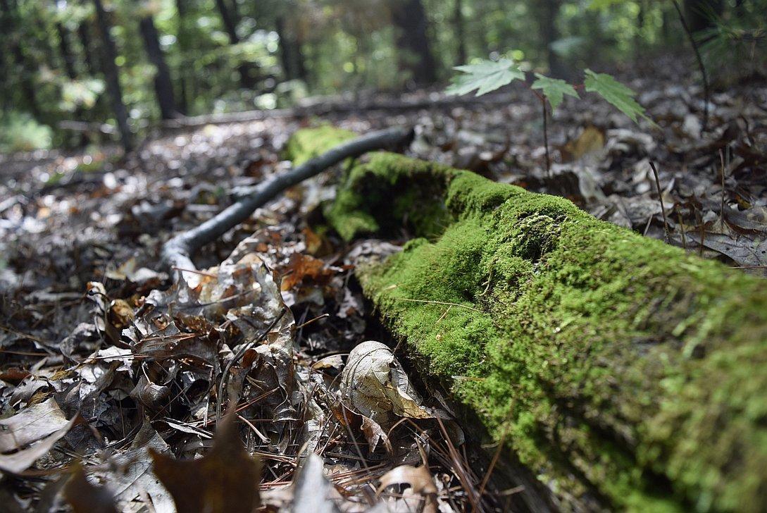
34 Acre Wetlands
The stream on the property runs through most of the donated acreage. And there are also DEC (Dept. of Environmental Conservation) wetlands mostly on the low lying land on the Moe Road side of the parcel. All the property is forested or open space today.
Once the property is developed, then many of the trees will be removed and almost half of the land—all on higher ground—will be covered with either buildings or parking lots. That means this land will no longer be able to absorb rainwater and storm water runoff. All that water from the higher, paved property will now flow south west into the “donated” land making it substantially wetter, less attractive for recreation and even more attractive to mosquitos, and mosquito-borne illnesses. This would not be beneficial so close to the school campus or for any residents or visitors using the property for recreation.